OUR TRAVEL-NAVIGATION EQUIPMENT
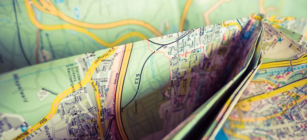
For the most travelers a properly working navigation is essential, when they don't wanna lose lots of time with unfolding huge maps, searching for a desired location. In the old days there weren't so called navigation systems. We only had those paper maps, which made it hard to find what we were searching for.
I remember those times very well. I was driving the road and asked my girl for the route and then the disaster began. While driving, she unfolded this huge map and I wasn't even able anymore to grab the gear shifter.
"Oh sorry... I need to rotate it, it's upside down".
I really don't know how often we missed a sign or a crossing and how often we were forced to stop.
When in the 90's the first navigation systems have been published, they were just unaffordable. A few years later, they became affordable for everyone. My time has come... great stuff.
I grabbed all my money and bought an Alpine Super-High-End navitainer with a huge screen for my former Honda S 2000. From now on, everything became better. No dozens of maps anymore, rather than having all you need on a small silverling, called CD-Rom.
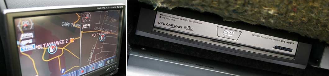
Navigation Equipment In My Former Honda S 2000, back in 2004
Laptop Navigation
The solution has been a laptop and a navigation software. But where to get such a software? There have been a few providers of such tools only, most of those softwares were much too complicated.
I started with Tumonz for my New Zealand journey, but it worked only for that part of the world. In South Africa, I used Fugawi. It wasn't a navigation software actually, rather than a tool, where you were forced to build your own maps. The philosophy has been, to scan a real map to a bitmap-image and to initialize the maps with a topographical survey. I really cannot describe anymore, how it worked, but I remember, that - according to the pixel size of the image - I needed to re-measure and to coordinate every single piece of the map. In this case it took months to build all maps (really), that have been working and which have been guiding me the right way.
With a host software and a small GPS device, which I put on the hood of our car, I was rather badly able to navigate... but hey... it worked somehow and I found my way... Job Done!
But from year to year more and more tools arose on the market. One of them has been Microsoft's "Streets & Trips" or "Autoroute", "Map & Guide", "Delorme", "VeZa Route" and plenty of others.
What I never used, are those tiny devices from Garmin or Tom-Tom, as I heard many people complaining about too much trouble with those toys.
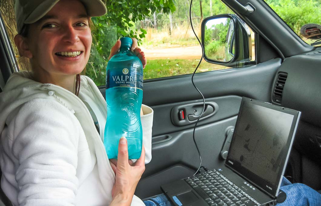
Sonja In 2006 In South Africa, Navigating With A Laptop And Fugawi
Smartphones And Tablets Are Conquering The World
Planning a route with online tools like Google Maps is a pain in the ass... sorry for the bad "a"-word, but it is anything else than comfortable. Searching for nice locations, points of interests or for some nice offraod roads however, works perfectly with Google Earth.
Nowadays laptop navigation is pretty much outdated, even those small navi-devices aren't so much popular anymore.
But with the smartphone boom, a new area has been born. Smartphone apps sprout up like mushrooms to the market. For every single country there were either free or commercial apps. From my experience, the most of them didn't work very well, (I tested dozens of them), but some of them became the leaders on the market.
These leaders are for sure Navigon, Falk, Sygic and CoPilot. There might be some other good solutions already, but these four I tested over the years (in parallel mode)
What I do NOT like, are navigation tools with online maps, for instance Google Maps (which has offline maps too, very recently) and many others. It just doesn't make sense, to invest lots of network-traffic, just for getting a route calculated. Sorry->NO!
A good compromise seem to be Android apps like OziExplorer, Locus Pro and others. They offer online and offline navigation, track recording and come with many other features, which might be helpful. They also have an import function, but they won't come with fancy 3d and a proper voice guided navigation.
I've tested Locus Pro so far. It's great, but in recording mode, it consumpts more power, than it gets from a charger.
After years of testing, I found in Navigon, CoPilot and Sygic the best solutions.
And if you wanna get the very best -> get Sygic!
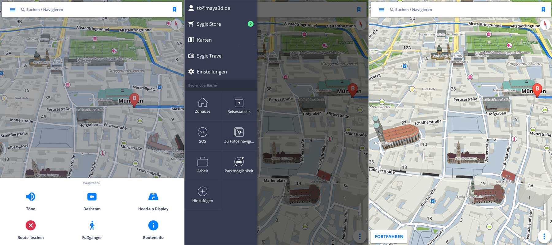
A Must Have : SYGIC Worldwide Navigation
SYGIC - With 3D Navigation, Dashcam And Head-Up Display Mode
Navigon worked super great for a couple of years, but it became slow... very slow, furthermore it unloaded all my smartphones too fast.
CoPilot is my 2nd place. It's fast, reliable and a very good way to go.
But when I started to plan my Japan journey a few years ago, there weren't any Japan maps available for CoPilot and I examined, that not a single navigation solution offered Japan maps. It might have had political reasons, but I just didn't care. I just needed a proper Japan map.
So I stumbled over Sygic. Even if it didn't offer Japan maps in the past too, I liked it somehow and stayed with it, until today.
In the past also Sygic had its drawbacks and I had lots of trouble with the support, but a couple of years later, it has been fully grown to a perfect run-and-gun navigation package, which also knows pretty much kinda offroad tracks.
Sygic is just outstanding:
It offers a fully (and real) 3D-navigation for the whole planet (incl. Japan!) and it's super fast on my SONY Xperia Z1. It's pretty simple to use and has a good working coordinate-mode, as well as anything else, which is working really nice.
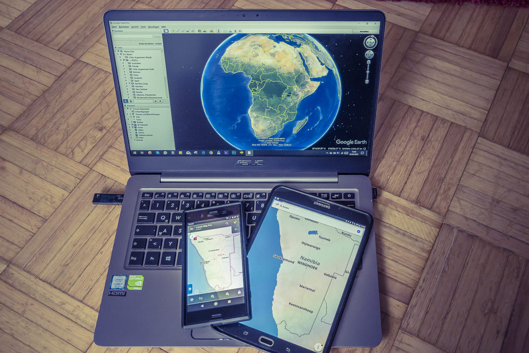
Our Navigation Equipment: Asus Zenbook UX3410UQ, Samsung Galaxy S2 Tab, SONY XPeria Z1
The voice-assisted route-guiding works perfect.
With other systems I had the problem, that when I was driving too fast, the route-guiding has been too slow, so that I missed dozens of motorway exits.
But one of the biggest advantages is the possibility, to put your own created waypoints onto your smartphone or tablet. Sygic will recognize the data and will import it into its own system and that is done in just a few seconds of work.
Sharing own waypoints will work too with other solutions, but much too complicated and in some cases, your phone needs to be rooted.
OK, the price of Sygic is a bit higher, but you'll get a very nice solution (World Lifetime License with world wide maps), which are properly updated, bug fixed and which have a good support (mostly, not always 😉 )
When traveling, I always have a fall back solution. Therefore I'm using more than one device for navigating:
. On my SONY XPeria Z1 and on my Samsung Galaxy Tab S2 8" , I'm using Sygic.
. On my girls iPhone, there's still Navigon installed and on my small Windows 10 laptop, I'm using ITN Converter and Route Converter, together with Google Earth and a small Navilock-GPS device.
In one of my upcoming "How To's" I will explain more in deep, how to properly plan a good and precise route and how to spread it onto all your different devices.